Wednesday 4 May 2016

>> History of Thailand

There is evidence of human habitation in Thailand that has been dated at 40,000 years before the present, with stone artefacts dated to this period at Tham Lod Rockshelter in Mae Hong Son. Similar to other regions in Southeast Asia, Thailand was heavily influenced by the culture and religions of India, starting with the Kingdom of Funan around the 1st century CE to the Khmer Empire. Thailand in its earliest days was under the rule of the Khmer Empire, which had strong Hindu roots, and the influence among Thais remains even today.

Indian influence on Thai culture was partly the result of direct contact with Indian settlers, but mainly it was brought about indirectly via the Indianized kingdoms of Dvaravati, Srivijaya, and Cambodia. E:A Voretzsch believes that Buddhism must have been flowing into Siam from India in the time of the Indian Emperor Ashoka of the Maurya Empire and far on into the first millennium after Christ. Later Thailand was influenced by the south Indian Pallava dynasty and north Indian Gupta Empire.

The ruins of Wat Chaiwatthanaram at Ayutthaya.

According to George Cœdès, "The Thai first enter history of Farther India in the eleventh century with the mention of Syam slaves or prisoners of war in" Champa epigraphy, and "in the twelfth century, the bas-reliefs of Angkor Wat" where "a group of warriors" are described as Syam. Additionally, "the Mongols, after the seizure of Ta-li on January 7, 1253 and the pacification of Yunnan in 1257, did not look with disfavor on the creation of a series of Thai principalities at the expense of the old Indianized kingdoms." The Menam Basin was originally populated by the Mons, and the location of Dvaravati in the 7th century, followed by the Khmer Empire in the 11th. The History of the Yuan mentions an embassy from the kingdom of Sukhothai in 1282. In 1287, three Thai chiefs, Mangrai, Ngam Muang, and Ram Khamhaeng formed a "strong pact of friendship".

After the fall of the Khmer Empire in the 13th century, various states thrived there, established by the various Tai peoples, Mons, Khmers, Chams and Ethnic Malays, as seen through the numerous archaeological sites and artefacts that are scattered throughout the Siamese landscape. Prior to the 12th century however, the first Thai or Siamese state is traditionally considered to be the Buddhist Sukhothai Kingdom, which was founded in 1238.

Stupas, Ayutthaya Historical Park.

Following the decline and fall of the Khmer empire in the 13th–15th century, the Buddhist Tai kingdoms of Sukhothai, Lanna, and Lan Xang (now Laos) were on the rise. However, a century later, the power of Sukhothai was overshadowed by the new Kingdom of Ayutthaya, established in the mid-14th-century in the lower Chao Phraya River or Menam area.

Ayutthaya's expansion centred along the Menam while in the northern valleys the Lanna Kingdom and other small Tai city-states ruled the area. In 1431, the Khmer abandoned Angkor after Ayutthaya forces invaded the city. Thailand retained a tradition of trade with its neighbouring states, from China to India, Persia, and Arab lands. Ayutthaya became one of the most vibrant trading centres in Asia. European traders arrived in the 16th century, beginning with the Portuguese, followed by the French, Dutch, and English. The Burmese–Siamese War (1765–1767) left Ayutthaya burned and sacked by King Hsinbyushin.

Location of  Thailand  (green)in ASEAN  (dark grey)

After the fall of Ayutthaya in 1767 to the Burmese, Taksin moved the capital to Thonburi for approximately 15 years. The current Rattanakosin era of Thai history began in 1782 following the establishment of Bangkok as capital of the Chakri Dynasty under King Rama I the Great. According to the Encyclopædia Britannica, "A quarter to a third of the population of some areas of Thailand and Burma were slaves in the 17th through the 19th centuries."

Despite European pressure, Thailand is the only Southeast Asian nation to never have been colonised. This has been ascribed to the long succession of able rulers in the past four centuries who exploited the rivalry and tension between French Indochina and the British Empire. As a result, the country remained a buffer state between parts of Southeast Asia that were colonised by the two colonial powers, Great Britain and France. Western influence nevertheless led to many reforms in the 19th century and major concessions, most notably the loss of a large territory on the east side of the Mekong to the French and the step-by-step absorption by Britain of the Shan and Karen people areas and Malay Peninsula.
(source)

>> Kraton of Yogyakarta serves as a cultural center for the Javanese people

Kraton of Yogyakarta (formally known as: Keraton Ngayogyakarta Hadiningrat) is a palace complex located in the city of Yogyakarta, Yogyakarta Special Region, Indonesia. The palace is the main seat Sultan of Yogyakarta and his family. It serves as a cultural center for the Javanese people and contains a museum that displays the sultanate's artifacts.

Yogyakarta Palace was built by Prince Mangkubumi in 1755-1756 (Javanese year: 1682), several months after the signing of the Treaty of Giyanti between Prince Mangkubumi of Yogyakarta, Hamengkubuwono of Surakarta and Dutch East India Company. A Banyan Forest was chosen as the site of the palace due to its location between two rivers which were considered good protection from possible flooding.

Pagelaran hall of Yogyakarta Kraton

On 20 June 1812, Stamford Raffles led a 1,200-strong British force to attack the walled royal city of Yogyakarta. The Javanese, although outnumbering the invader, weren't prepared for the attack and were taken back by the event. In one day the city of Yogyakarta fell and the royal palace was sacked and burned. The total loot from the palace valued £15,000 in gold, jewels and hard currency (which values £500,000 today). The event was the first time an attack has been carried out into a court in Java and as a result the sultanate was completely subjugated to colonial authority.

Most of the palace's current form are built by Sultan Hamengkubuwono VIII who reign from 1921 to 1939. It suffered from an earthquake in 1876 and 2006, and was subsequently rebuilt after the devastation.

One of the pavilions (bangsal)

Kraton means the place where the "ratu" (in English: Queen, in Javanese also mean: King) resides. The word "Keraton" (Keraton is living quarter of the royal family in the palace) (shortened form of ratu/Ka-ratuan) derived from the word "Ratu" which in Malay means king. The palace was built according to Javanese Philosophy and is shrouded by mysticism. The spatial arrangement of the palace, including the cityscape of the old city of Yogyakarta, including its architecture, direction of buildings, and objects all belongs to the mythological value and belief system of the Javanese. The main street of the old city forms a straight line from Tugu Yogyakarta, Kraton, Mount Merapi to Krapyak Hunting House. The layout mean "the origin of human beings and their last purposes" (Javanese: sangkan paraning dumadi).

Kraton Yogyakarta featured in 1,000-rupiah banknote.

The road from Krapyak Hunting House to the palace symbolizes the first creation of men stage to adulthood. The villages surrounding Krapyak Hunting House are named "Mijen" from the word Wiji (seed). Along the way Tamarind and Spanish cherry trees are planted to represent the journey from childhood to adulthood. It then goes to Tugu Yogyakarta and finally ends at the palace, meaning the end of human life and meeting the Creator. And finally the seven gates of Gladhag to Donopratopo means the seven step to Heaven.

Gilig Golong Monument, popularly known as Tugu Yogyakarta.

Tugu Yogyakarta (Gilig golong monument) located on the north side of the old city is a symbol of "unification between the king (golong) and the people (gilig)" (Javanese: manunggaling kawulo gusti). It also symbolizes the final unity of the creator (Khalik) and His subjects. Gate Donopratoro (Gate to Kedaton quarter) means "a good person is someone who is generous and knows how to control his lust" and the two Dwarapala statues, named Balabuta and Cinkarabala, each represent good and evil. The palace's magical artifacts are believed to have the power to repulse evil intention.
(source)

>> Yogyakarta or Jogjakarta renowned as a center of education, classical Javanese fine art and culture

Yogyakarta, also Jogja or Jogjakarta, is a city and the capital of Yogyakarta Special Region in Java, Indonesia. It is renowned as a center of education (Kota Pelajar), classical Javanese fine art and culture such as batik, ballet, drama, music, poetry, and puppet shows. Yogyakarta was the Indonesian capital during the Indonesian National Revolution from 1945 to 1949, with Gedung Agung as the president's office. One of the districts in Yogyakarta, Kotagede, was the capital of the Mataram Sultanate between 1575 and 1640. The city is named after the Indian city of Ayodhya from the Ramayana epic. Yogya means "suitable, fit, proper", and karta, "prosperous, flourishing" (i.e., "a city that is fit to prosper").

Location of Yogyakarta in Indonesia

Its population was 388,627 inhabitants at the 2010 census and its built-up (or metro) area was home to, 4,010,436 inhabitants spread on two cities (Yogyakarta and Magelang) and 65 districts spread on Sleman, Klaten, Bantul, Kulon Progo and Magelang regencies. While urbanization sprawls, Yogyakarta-Magelang and Surakarta are being agglomerated in a few years. The Dutch name of the city is Djokjakarta.

History 
Mataram Kingdom (8th – 10th century CE) 
According to Canggal inscription dated 732, the area traditionally known as "Mataram" became the capital of the Medang Kingdom, identified as Mdang i Bhumi Mataram established by King Sanjaya. Mataram became the center of a refined and sophisticated Javanese Hindu-Buddhist culture, for about three centuries its heartland in Kewu Plain (southern slope of Mount Merapi) around Prambanan witnessed the construction of numerous candi including Borobudur and Prambanan.

Kotagede, former capital of the Mataram Sultanate.

Around the year 929, the centre of the kingdom was shifted to East Java by Mpu Sindok, who established the Isyana Dynasty. The exact cause of the move is still uncertain; however, a severe eruption of Mount Merapi volcano or a power struggle probably caused the move. Historians suggest that, some time during the reign of King Wawa of Mataram (924–929), Merapi volcano erupted and devastated the kingdom's capital in Mataram.

Majapahit Empire (1293–1527) 
During the Majapahit era, the area surrounding modern Yogyakarta was identified again as "Mataram" and recognized as one of the twelve Majapahit provinces in Java ruled by a Duke titled 'Bhre Mataram'. During the reign of Hayam Wuruk (1350 to 1389), the title of Bhre Mataram was held by king's nephew and son in-law Wikramawardhana.

Mataram Sultanate (1575–1620)
Kotagede (now a district of Yogyakarta) was established as the capital of the Mataram Sultanate. During the reign of Sultan Agung Hanyokrokusumo (1613-1645), the Sultanate Mataram reached its zenith as the greatest kingdom in Java, and expanded its influence to Central Java, East Java and half of West Java. After two changes of capital, (Palace of Pleret and Place of Kerta, both located in Bantul Regency), the capital of Mataram Sultanate moved to Kartasura.

Aftermath of the Gianti Treaty (1745–1945)
During the reign of Pakubuwono II, a civil war broke out in Mataram Sultanate. The civil war was fought between Prince Mangkubumi and his elder brother, Sunan Pakubuwono II. It started when Sunan Pakubuwono II agreed to cooperate with the VOC, ceded some Mataram territory to the Dutch, and submitted to the foreign power. His younger brother, Prince Mangkubumi stood against the agreement due to concerns that his people would become slaves under Dutch rule. Prince Mangkubumi defeated the Pakubuwono forces and declared sovereignty in the Kingdom of Yogjakarta occupying the southern parts of the former Mataram Sultanate.

The Yogyakarta sultanate palace's main pavilion

The Yogyakarta Sultanate was established as a result of the Treaty of Giyanti (Perjanjian Gianti) by Prince Mangkubumi, who later ascended the throne as Sultan Hamengkubuwono I. Officially, the creation of Yogyakarta Sultanate is dated at 7 October 1756 as a result of civil war among the princes of The Mataram Sultanate. This civil war marked the end of the Mataram Sultanate and resulted in the birth of the Yogyakarta Sultanate and the Surakarta Sunanate.

During the British occupation of Java, rumors of plans by the Javanese court to stage a rebellion caused uneasiness among the colonial authorities. On 20 June 1812, Stamford Raffles led a 1,200-strong British force to attack the royal city. The Javanese were surprised by the attack and were easily subdued. In one day the city of Yogyakarta fell, with the city destroyed and its palace looted. The event completely stripped the sultanate of its remaining power and influence. The sack also left the court humiliated and fueled a rebellion which would be known as Java War.

Republic of Indonesia era (1945–present)
In 1942 the Japanese Empire invaded Dutch East Indies and ruled Java until they were defeated in 1945. Sukarno proclaimed the independence of the Indonesian Republic on August 1945. Sultan Hamengkubuwono IX promptly sent a letter to Sukarno, expressing his support for the newly born nation of Indonesia and acknowledging the Yogyakarta Sultanate as part of the Indonesian Republic. The Sunanate of Surakarta did the same, and both of the Javanese kingdoms were awarded special status as "Special Regions" within the Indonesian Republic. However, because of a leftist anti-royalist uprising in Surakarta, the Sunanate of Surakarta lost its special administrative status in 1946 and was absorbed into Central Java Province.

The Taman Sari Water Castle

Yogyakarta's support was essential in the Indonesian struggle for independence during the Indonesian National Revolution (1945-1949). The city of Yogyakarta became the capital of the Indonesian Republic from 1946 to 1948, after the fall of Jakarta to the Dutch. Later the Dutch also invaded Yogyakarta, causing the Republic's capital to be transferred once again, to Bukittinggi in West Sumatra on 19 December 1948. Because of its significant contribution to the survival of the Indonesian Republic, Yogyakarta was given the status of Special Administrative Region, making Yogyakarta the only region headed by a monarchy in Indonesia.
(source)

>> Pura Besakih is a temple complex in the village of Besakih on the slopes of Mount Agung in eastern Bali, Indonesia

Pura Besakih is a temple complex in the village of Besakih on the slopes of Mount Agung in eastern Bali, Indonesia. It is the most important, the largest and holiest temple of Hindu religion in Bali, and one of a series of Balinese temples. Perched nearly 1000 meters up the side of Gunung Agung, it is an extensive complex of 23 separate but related temples with the largest and most important being Pura Penataran Agung. The temple is built on six levels, terraced up the slope. The entrance is an formed by a Candi Bentar (split gateway), and beyond it the Kori Agung is the gateway to the second courtyard.

The early morning sun hits the spires of Pura Besakih

The precise origins of the temple are not clear but it almost certainly dates from prehistoric times. The stone bases of Pura Penataran Agung and several other temples resemble megalithic stepped pyramids, which date back at least 2000 years. It was certainly used as a Hindu place of worship from 1284 when the first Javanese conquerors settled in Bali. By the 15th century, Besakih had become a state temple of the Gelgel dynasty. It was built on the south slopes of Mount Agung, the principal volcano of Bali.

Pura Besakih is a complex made up of twenty-three temples that sit on parallel ridges. It has stepped terraces and flights of stairs which ascend to a number of courtyards and brick gateways that in turn lead up to the main spire or Meru structure, which is called Pura Penataran Agung. All this is aligned along a single axis and designed to lead the spiritual person upward and closer to the mountain which is considered sacred.

Location in Bali; high on Mount Agung

The main sanctuary of the complex is the Pura Penataran Agung. The symbolic center of the main sanctuary is the lotus throne or padmasana, which is therefore the ritual focus of the entire complex. It dates to around the seventeenth century.

A series of eruptions of Mount Agung in 1963, which killed approximately 1,700 people also threatened Pura Besakih. The lava flows missed the temple complex by mere meters. The saving of the temple is regarded by the Balinese people as miraculous, and a signal from the gods that they wished to demonstrate their power but not destroy the monument the Balinese faithful had erected.

A prayer ceremony at Besakih Temple

Each year there are at least seventy festivals held at the complex, since almost every shrine celebrates a yearly anniversary. This cycle is based on the 210-day Balinese Pawukon calendar year.

It had been nominated as a World Heritage Site as early as 1995, but remains unvested.

Visitors to this temple should exercise caution as there is a syndicate operating in and around the premise of this temple. They target tourists by offering a compulsory "tour guide" at exorbitant charges. They also perform "prayers" and request for tips at the end of the "tour". Visitors who decline their "services" are dealt with rather aggressively.
(source)

>> The Redwood National and State Parksare old-growth temperate rainforests located at along the coast of northern California

The Redwood National and State Parks (RNSP) are old-growth temperate rainforests located in the United States, along the coast of northern California. Comprising Redwood National Park (established 1968) and California's Del Norte Coast, Jedediah Smith, and Prairie Creek Redwoods State Parks (dating from the 1920s), the combined RNSP contain 133,000 acres (540 km2). Located entirely within Del Norte and Humboldt Counties, the four parks, together, protect 45% of all remaining coast redwood (Sequoia sempervirens) old-growth forests, totaling at least 38,982 acres (157.75 km2). These trees are the tallest and one of the most massive tree species on Earth. In addition to the redwood forests, the parks preserve other indigenous flora, fauna, grassland prairie, cultural resources, portions of rivers and other streams, and 37 miles (60 km) of pristine coastline.

Location of Redwood National and State Parks

In 1850, old-growth redwood forest covered more than 2,000,000 acres (8,100 km2) of the California coast. The northern portion of that area, originally inhabited by Native Americans, attracted many lumbermen and others turned gold miners when a minor gold rush brought them to the region. Failing in efforts to strike it rich in gold, these men turned toward harvesting the giant trees for booming development in San Francisco and other places on the West Coast. After many decades of unrestricted clear-cut logging, serious efforts toward conservation began.

By the 1920s the work of the Save-the-Redwoods League, founded in 1918 to preserve remaining old-growth redwoods, resulted in the establishment of Prairie Creek, Del Norte Coast, and Jedediah Smith Redwoods State Parks among others. Redwood National Park was created in 1968, by which time nearly 90% of the original redwood trees had been logged. The National Park Service (NPS) and the California Department of Parks and Recreation (CDPR) administratively combined Redwood National Park with the three abutting Redwood State Parks in 1994 for the purpose of cooperative forest management and stabilization of forests and watersheds as a single unit.

Fog in the forest

The ecosystem of the RNSP preserves a number of threatened animal species such as the tidewater goby, Chinook salmon, northern spotted owl, and Steller's sea lion.[6] In recognition of the rare ecosystem and cultural history found in the parks, the United Nations designated them a World Heritage Site on September 5, 1980 and an International Biosphere Reserve on June 30, 1983.

History
Modern day Native groups such as the Yurok, Tolowa, Karok, Chilula, and Wiyot all have historical ties to the region, and some Native American groups still live in the park area today. Archaeological study shows they arrived in the area as far back as 3,000 years ago. An 1852 census determined that the Yurok were the most numerous, with 55 villages and an estimated population of 2,500. They used the abundant redwood, which with its linear grain was easily split into planks, as a building material for boats, houses, and small villages. For buildings, the planks would be erected side by side in a narrow trench, with the upper portions bound with leather strapping and held by notches cut into the supporting roof beams. Redwood boards were used to form a shallow sloping roof.

Previous to Jedediah Smith in 1828, no other explorer of European descent is known to have thoroughly investigated the inland region away from the immediate coast. The discovery of gold along the Trinity River in 1850 led to a minor secondary rush in California. This brought miners into the area and many stayed on at the coast after failing to strike it rich. This quickly led to conflicts wherein native peoples were placed under great strain, if not forcibly removed or massacred. By 1895, only one third of the Yurok in one group of villages remained; by 1919, virtually all members of the Chilula tribe had either died or been assimilated into other tribes.

The miners logged redwoods for building; when this minor gold rush ended, some of them turned again to logging, cutting down the giant redwood trees. Initially, over 2,000,000 acres (8,100 km2) of the California and southwestern coast of Oregon were old-growth redwood forest, but by 1910, extensive logging led conservationists and concerned citizens to begin seeking ways to preserve the remaining trees, which they saw being logged at an alarming rate. In 1911, U.S. Representative John E. Raker, of California, became the first politician to introduce legislation for the creation of a redwood national park. However, no further action was taken by Congress at this time.

Reconstruction of a Yurok Native American plankhouse constructed of redwood boards

Preservation of the redwood stands in California is considered one of the most substantial conservation contributions of the Boone and Crockett Club. The Save-the-Redwoods League was founded in 1918 by Boone and Crockett Club members Madison Grant, John C. Merriam, Henry Fairfield Osborn, and future member, Frederick Russell Burnham. The initial purchases of land were made by Club member Stephen Mather and Mr. William Kent. In 1921, Boone and Crockett Club member Dr. John C. Phillips donated $32,000 to purchase land and create the Raynal Bolling Memorial Grove in the Humboldt Redwoods State Park.

This was timely as U.S. Route 101, which would soon provide nearly unfettered access to the trees, was under construction. Using matching funds provided initially by the County of Humboldt and later by the State of California, the Save-the-Redwoods League managed to protect areas of concentrated or multiple redwood groves and a few entire forests in the 1920s. As California created a state park system, beginning in 1927, three of the preserved redwood areas became Prairie Creek Redwoods, Del Norte Coast Redwoods, and Jedediah Smith Redwoods State Parks. A fourth became Humboldt Redwoods State Park, by far the largest of the individual Redwood State Parks, but not in the Redwood National and State Park system. Because of the high demand for lumber during World War II and the construction boom that followed in the 1950s, the creation of a national park was delayed. Efforts by the Save-the-Redwoods League, the Sierra Club, and the National Geographic Society to create a national park began in the early 1960s.

The coast redwood is the tallest tree species on Earth.

After intense lobbying of Congress, the bill creating Redwood National Park was signed by President Lyndon Johnson on October 2, 1968. The Save-the-Redwoods League and other entities purchased over 100,000 acres (400 km2), which were added to existing state parks. In 1978, 48,000 acres (190 km2) were added to Redwood National Park in a major expansion. However, only a fifth of that land was old-growth forest, the rest having been logged. This expansion protected the watershed along Redwood Creek from being adversely affected by logging operations outside the park. The federal and state parks were administratively combined in 1994.

The United Nations designated Redwood National and State Parks a World Heritage Site on September 5, 1980. The evaluation committee noted 50 prehistoric archaeological sites, spanning 4,500 years. It also cited ongoing research in the park by Humboldt State University researchers, among others. The park is part of a much larger region designated the California Coast Ranges International Biosphere Reserve on June 30, 1983. The California Coast Ranges biosphere is overseen by the University of California Natural Reserve System.

The park has served as a filming location for numerous films. Scenes set on the forest moon Endor in Star Wars Episode VI: Return of the Jedi were filmed in the Tall Trees Redwood Grove in the northern part of Humboldt County, though the majority of filming was in private and public forests near the town of Smith River, California. Scenes for The Lost World: Jurassic Park as well as the movie Outbreak were filmed at the nearby Prairie Creek Redwoods State Park and at Patrick's Point State Park.
(source)

>> The Indigenous peoples of California who have lived or currently live in the geographic area

The Indigenous peoples of California (known as Native Californians) are the indigenous inhabitants who have lived or currently live in the geographic area within the current boundaries of California before and after the arrival of Europeans. With over one hundred federally recognized tribes, California has the largest Native American population and the most distinct tribes of any US state. Californian tribes are characterized by linguistic and cultural diversity.

The California cultural area does not exactly conform to the state of California's boundaries. Many tribes on the eastern border with Nevada are classified as Great Basin tribes, and some tribes on the Oregon border are classified as Plateau tribes. Tribes in Baja California who do not cross into California are classified as Indigenous peoples of Mexico.

Before European contact, native Californians spoke over 300 dialects of approximately 100 distinct languages. The large number of languages has been related to the ecological diversity of California, and to a sociopolitical organization into small tribelets (usually 100 individuals or fewer) with a shared "ideology that defined language boundaries as unalterable natural features inherent in the land".

A map of California tribal groups and languages at the time of European contact.

"The majority of California Indian language belong either to highly localized language families with two or three members (e.g. Yukian, Maiduan) or are language isolates (e.g. Karuk, Esselen)." Of the remainder, most are Uto-Aztecan or Athapaskan languages. Larger groupings have been proposed. The Hokan superstock has the greatest time depth and has been most difficult to demonstrate; Penutian is somewhat less controversial.

There is evidence suggestive that speakers of the Chumashan languages and Yukian languages, and possibly languages of southern Baja California such as Waikuri, were in California prior to the arrival of Penutian languages from the north and Uto-Aztecan from the east, perhaps predating even the Hokan languages. Wiyot and Yurok are distantly related to Algonquian languages in a larger grouping called Algic. The several Athapaskan languages are relatively recent arrivals, no more recent than about 2000 years ago.

Linguistic anthropologist Jocelyn C. Ahlers writes that there are "ideologies on the deployment of silence as a salient attribute of women's speech in contexts which are framed as traditional and closely tied to Native California languages of heritage."

Evidence of human occupation of California dates from at least 17,000 BCE. Prior to European contact, California Indians had 500 distinct sub-tribes or groups, each consisting of 50 to 500 individual members. The size of California tribes today are small compared to tribes in other regions of the United States. Prior to contact with Europeans, the California region contained the highest Native American population density north of what is now Mexico. Because of the temperate climate and easy access to food sources, approximately one-third of all Native Americans in the United States were living in the area of California.

Early Native Californians were hunter-gatherers, with seed collection becoming widespread around 9,000 BCE. Due to the local abundance of food, tribes never developed agriculture or tilled the soil. Two early southern California cultural traditions include the La Jolla Complex and the Pauma Complex, both dating from ca. 6050—1000 BCE. From 3000 to 2000 BCE, regional diversity developed, with the peoples making fine-tuned adaptations to local environments. Traits recognizable to historic tribes were developed by approximately 500 BCE.

The indigenous people practiced various forms of sophisticated forest gardening in the forests, grasslands, mixed woodlands, and wetlands to ensure availability of food and medicine plants. They controlled fire on a regional scale to create a low-intensity fire ecology; this prevented larger, catastrophic fires and sustained a low-density "wild" agriculture in loose rotation. By burning underbrush and grass, the natives revitalized patches of land and provided fresh shoots to attract food animals. A form of fire-stick farming was used to clear areas of old growth to encourage new in a repeated cycle; a primitive permaculture.

Different tribes encountered non-Natives at widely different times. The southern and central coastal tribes encountered Spanish and British explorers in the mid-16th century. In remote interior regions, some tribes did not meet non-Natives until the mid-19th century.

Some other tribes, such as the Quechan or Yuman Indians in present-day southeast California and southwest Arizona, were the first to encounter Spanish explorers in the 1760s and 1770s. But others on the coasts of northwest California, such as the Miwok, Yurok and Yokut, came across Russian explorers and seafarers coming from Alaska in the late 18th century. Russians established Fort Ross, a short-lived fortified colony, in the early 1800s, 60 miles north of present-day San Francisco.

The Spanish began their long-term occupation in California in 1769 with the founding of Mission San Diego de Alcalá in San Diego. The Spanish built 20 additional missions in California.  Their introduction of European invasive plant species and non-native diseases resulted in unintended havoc and high fatalities for the Native populations.

The population of Native California was reduced by 90% during the 19th century—from more than 200,000 in the early 19th century to approximately 15,000 at the end of the century, mostly due to disease. Epidemics swept through California Indian Country, such as the 1833 malaria epidemic.

With Mexican independence in 1834, the Spanish missions were taken under Mexican control and secularized. But the new government did not return their lands to tribes but made land grants to settlers of at least partial European ancestry. Many landless Indians found wage labor on ranches. Following the United States victory in the Mexican-American War, it took control of California in 1848 with the signing of the Treaty of Guadalupe Hidalgo. Its administrators worked to honor Mexican land grant title but did not honor aboriginal land title.
(source)

>> Boudhanath one of the oldest and the biggest Buddhist monuments ever built in Nepal

Boudhanath is a colossal stupa north east of Pashupatinath and lies a further 2 km by road. One of the oldest and the biggest Buddhist monuments ever built in Nepal, Boudhanath is an imposing structure standing some 36 meters. This is declared to stand as the largest Buddhist shrine of South Asia. The Stupa stands on the massive three level mandala style Platforms surrounded by colourful private family houses.


The basic feature of this great stupa is very much like that of Swoyambhunath stupa except its finial displaying. It is much bigger than Swoyambhu stupa and lies on the valley floor whereas the former one stands on the hill top. This stupa is said to have been built in 5th century A. D. The site is considered very much like Mecca for the Tibetan Buddhists and every year tens of thousands of pilgrims from all over the Himalayan region visit the stupa. Some of the gompas surrounding Boudha are Sakyapa Gompa, Chinya-Lama Gompa, Nyingmapa Gompa, Kargyupa Gompa, Gelugpa Gompa etc.

According to a very popular legend long time ago the kingdom of Kathmandu was under terrifying draught. King Dharma Deva was very worried. An astrologer advised him that only the sacrifice of an ideal man with 32 virtues in front of the dry royal water spout could make the rain fall in the country. And in the following night he commanded his son to go to the dry water spout inside the royal palace compound at mid night and behead the person shrouded in white robe without looking at him.


The Prince obeyed his father but to his great horror only to find it was none other than his own father. In order to atone the big sin and in removal the prince said to have built this great stupa. As an entry point of ancient Nepal-Tibet trade rout, the site is popularly frequented by Tibetan visitors. During Lhosar festival the pilgrims worship the Buddhist deities, light the increase and butter lamp day and night. Every twelve year a special ceremony is observed with great gusto and fervor . During that time they dance, play musical instruments, chant and hymns.

>> The Raja Ampat archipelago is the part of Coral Triangle which contains the richest marine biodiversity on earth

Located off the northwest tip of Bird's Head Peninsula on the island of New Guinea, in Indonesia's West Papua province, Raja Ampat, or the Four Kings, is an archipelago comprising over 1,500 small islands, cays, and shoals surrounding the four main islands of Misool, Salawati, Batanta, and Waigeo, and the smaller island of Kofiau. The Raja Ampat archipelago is the part of Coral Triangle which contains the richest marine biodiversity on earth.

Raja Ampat Regency is a new regency which separated from Sorong Regency in 2004. The population of the Regency was recently (January 2014) put at 49, 048. It encompasses more than 40,000 km² of land and sea, which also contains Cenderawasih Bay, the largest marine national park in Indonesia. It is a part of the newly named West Papua province of Indonesia which was formerly Irian Jaya. Some of the islands are the most northern pieces of land in the Australian continent.


Raja Ampat is considered the global epicenter of tropical marine bio-diversity and is referred to as The Crown Jewel of the Bird's Head Seascape, which also includes Cenderawasih Bay and Triton Bay.

The name of Raja Ampat comes from local mythology that tells about a woman who finds seven eggs. Four of the seven eggs hatch and become kings that occupy four of Raja Ampat biggest islands whilst the other three become a ghost, a woman, and a stone.

History shows that Raja Ampat was once a part of Sultanate of Tidore, an influential kingdom from Maluku. Yet, after the Dutch invaded Maluku, it was shortly claimed by the Netherlands.

The first recorded sighting and landing by Europeans of the Ampat Islands was in the person of the Portuguese navigator Jorge de Menezes and his crew in 1526, on route from Biak, the Bird's Head Peninsula, and Waigeo, to Halmahera (Ternate).

The English explorer William Dampier gave his name to Dampier Strait, which separates Batanta island from Waigeo island. To the east, there is a strait that separates Batanta from Salawati. In 1759 Captain William Wilson sailing in the East Indiaman Pitt navigated these waters and named one strait Pitt strait, after his vessel; this was probably the channel between Batanta and Salawati.

Panoramic view

The main occupation for people around this area is fishing since the area is dominated by the sea. They live in a small colony of tribes that spreads around the area. Although traditional culture still strongly exists, they are very welcoming to visitors. Raja Ampat people are more like Ambonese than Papuan people and now some of them are Muslim and some of them are Christian.

The oceanic natural resources around Raja Ampat give it significant potential as a tourist area. Many sources place Raja Ampat as one of their top ten most popular places for diving whilst it retains the number one ranking in terms of underwater biodiversity.

According to Conservation International, marine surveys suggest that the marine life diversity in the Raja Ampat area is the highest recorded on Earth.[3] Diversity is considerably greater than any other area sampled in the Coral Triangle composed of Indonesia, Malaysia, Philippines, Papua New Guinea, Solomon Islands, and East Timor. The Coral Triangle is the heart of the world's coral reef biodiversity, making Raja Ampat quite possibly the richest coral reef ecosystems in the world.

The area's massive coral colonies along with relatively high sea surface temperatures, also suggest that its reefs may be relatively resistant to threats like coral bleaching and coral disease, which now jeopardize the survival of other coral ecosystems around the world. The Raja Ampat islands are remote and relatively undisturbed by humans.

Marine biodiversity of Raja Ampat

The high marine diversity in Raja Ampat is strongly influenced by its position between the Indian and Pacific Oceans, as coral and fish larvae are more easily shared between the two oceans. Raja Ampat's coral diversity, resilience, and role as a source for larval dispersal make it a global priority for marine protection.

1,508 fish species, 537 coral species (a remarkable 96% of all scleractinia recorded from Indonesia are likely to occur in these islands and 75% of all species that exist in the world ), and 699 mollusk species, the variety of marine life is staggering. Some areas boast enormous schools of fish and regular sightings of sharks, such as wobbegongs.

Raja Ampat Islands have at least three ponds containt unpoisoned jellyfish, all in Misool area.

Although accessing the islands is not that difficult, it takes some time. It takes six hours flight from Jakarta, the capital city of Indonesia to Sorong. Then, taking a boat to reach the islands is necessary.

The documentary film Edies Paradies 3 (by Otto C. Honegger) has been broadcast by the biggest Switzerland television broadcaster, Schweizer Fernsehen. The film tells about Raja Ampat's natural underwater beauty which is likened to Switzerland's only inhabited area of the region of around 50,000 residents and is considered like the "Amazon" because of the underwater world located in the heart of the world's Coral Triangle.
(source)

>> The Areopagus is the composite form of the Greek name Areios Pagos

The Areopagus is the composite form of the Greek name Areios Pagos, translated "Ares Rock" (Ancient Greek: Ἄρειος Πάγος). It is north-west of the Acropolis in Athens. In classical times, it functioned as the court for trying deliberate homicide Ares was supposed to have been tried here by the gods for the murder of Poseidon's son Alirrothios (a typical example of an aetiological myth).

The origin of its name is not clear. In Ancient Greek, πάγος pagos means "big piece of rock". Areios could have come from Ares or from the Erinyes, as on its foot was erected a temple dedicated to the Erinyes where murderers used to find shelter so as not to face the consequences of their actions. Later, the Romans referred to the rocky hill as "Mars Hill", after Mars, the Roman God of War. Near the Areopagus was also constructed the basilica of Dionysius Areopagites.

Acropolis of Athens view from Areopagus hill.

In pre-classical times (before the 5th century BC), the Areopagus was the council of elders of the city, similar to the Roman Senate. Like the Senate, its membership was restricted to those who had held high public office, in this case that of Archon. In 594 BC, the Areopagus agreed to hand over its functions to Solon for reform. He instituted democratic reforms, reconstituted its membership and returned control to the organization.

In 462 BC, Ephialtes put through reforms which deprived the Areopagus of almost all its functions except that of a murder tribunal in favour of Heliaia. In The Eumenides of Aeschylus (458 BC), the Areopagus is the site of the trial of Orestes for killing his mother (Clytemnestra) and her lover (Aegisthus).

Phryne, the hetaera from 4th century BC Greece and famed for her beauty, appeared before the Areopagus accused of profaning the Eleusinian mysteries. One story has her letting her cloak drop, so impressing the judges with her almost divine form that she was summarily acquitted. In an unusual development, the Areopagus acquired a new function in the 4th century BC, investigating corruption, although conviction powers remained with the Ecclesia.

The Areopagus as viewed from the Acropolis.

The Areopagus, like most city-state institutions, continued to function in Roman times, and it was from this location, drawing from the potential significance of the Athenian altar to the Unknown God, that the Apostle Paul is said to have delivered the famous speech, "Now what you worship as something unknown I am going to proclaim to you. The God who made the world and everything in it is the Lord of heaven and earth and does not live in temples built by hands."

The term "Areopagus" also refers to the judicial body of aristocratic origin that subsequently formed the higher court of modern Greece.
(source)

>> The Theatre of Dionysus Eleuthereus is a major theatre in Athens, built at the foot of the Athenian Acropolis

The Theatre of Dionysus Eleuthereus is a major theatre in Athens, built at the foot of the Athenian Acropolis. Dedicated to Dionysus, the god of plays and wine (among other things), the theatre could seat as many as 17,000 people with excellent acoustics, making it an ideal location for ancient Athens' biggest theatrical celebration, the Dionysia. It was the first stone theatre ever built, cut into the southern cliff face of the Acropolis, and supposedly birthplace of Greek tragedy. The remains of a restored and redesigned Roman version can still be seen at the site today. It is sometimes confused with the later, smaller and better-preserved Odeon of Herodes Atticus, located nearby on the southwest slope of the Acropolis.

The site was used as a theatre since the sixth century BC. The existing structure dates back to the fourth century BC but had many other later remodellings. On November 24, 2009 the Greek government announced that they would partially restore the Theatre of Dionysus.

Present-day remains of the Theatre of Dionysus Eleuthereus, Athens

The site of the Theatre of Dionysus Eleuthereus, on the south slope of the Athenian Acropolis, has been known since the 1700s. The Greek Archaeological Society excavated the remains of the theatre beginning in 1838 and throughout most of the 19th century. Early remains in the area relating to the cult of Dionysus Eleuthereus have been dated to the 6th century BC, during the rule of Peisistratus and his successors, but a theatre was apparently not built on the site until a century later. The only certain evidence of this early theatre consists of a few stone blocks that were reused in the fourth century BC.

During the sixth century BC, performances associated with the festivals of Dionysus were probably held in the Athenian agora, with spectators seated on wooden bleachers (ikria) set up around a flat circular area, the orchestra, until the ikria collapsed in the early fifth century BC, an event attested in ancient sources. After the collapse of the stands, the dramatic and musical contests were moved to the precinct of Dionysus on the slope of the Acropolis.

The early theatre must have been very simple, comprising a flat orchestra, with a few rows of wooden or stone benches set into the hill. The oldest orchestra in the theatre precinct is thought to have been circular (or nearly so) with a diameter of around 27 metres, although there is some debate as to its original size and shape. A wooden scene building (skene) was apparently introduced at the back of the orchestra, serving for the display of artificial scenery and perhaps to enhance the acoustics. It was in this unpretentious setting that the plays of the great fifth century BC Attic tragedians were performed.

By the end of the fifth century BC, some of the wooden constructions had been replaced with stone. The Theatre of Dionysus in its present general state dates largely to the period of the Athenian statesman Lycurgus (ca. 390-325/4 BC), who, as overseer of the city's finances and building program, refurbished the theatre in stone in monumental form. The fourth century theatre had a permanent stage extending in front of the orchestra and a three-tiered seating area (theatron) that stretched up the slope. The scene building had projecting wings at both ends (paraskenia), which might have accommodated stairways or movable scenery. According to Margarete Bieber, the earliest stone skene with remains surviving is that of the Theatre of Dionysus.

Marble thrones in the Theatre of Dionysus

Alterations to the stage were made in the subsequent Hellenistic period, and 67 marble thrones were added around the periphery of the orchestra, inscribed with the names of the dignitaries that occupied them. The marble thrones that can be seen today in the theatre take the form of klismos chairs, and are thought to be Roman copies of earlier versions. At the center of this row of seats was a grand marble throne reserved for the priest of Dionysus.

The Theatre of Dionysus underwent a modernization in the Roman period, although the Greek theatre retained much of its integrity and general form. An entirely new stage was built in the first century CE, dedicated to Dionysus and the Roman emperor Nero. By this time, the floor of the orchestra had been paved with marble slabs, and new seats of honor were constructed around the edge of the orchestra. Late alterations carried out in the third century AD by the archon Phaedrus included the re-use of earlier Hadrianic reliefs, which were built into the front of the stage building. The remains of a restored and redesigned Roman version of the theatre can still be seen at the site today.

The theatre was dedicated to Dionysus, the god of wine and the patron of drama; it hosted the City Dionysia festival. Among those who competed were the dramatists of the classical era whose works have survived: Aeschylus, Sophocles, Euripides, Aristophanes, and Menander. The advent of tragedy, in particular, is credited to the Athenians with festivals staged during specific times of year. These dramatic festivals were competitive among playwrights and involved the production of four plays, three tragedies and one satyr play featuring lighter themes. Early on, the subject matter of the four plays was often linked, with the three tragedies forming a trilogy, such as the Oresteia of Aeschylus. This famous trilogy (Agamemnon, Choephori, and Eumenides) won the competition of 458 BC held in the Theatre of Dionysus Eleuthereus. The plays tell the story of the curse on the House of Atreus: Agamemnon’s murder by his wife, the revenge of their son, Orestes, upon his mother, and Orestes’ trial in Athens.

Theatre of Dionysus Eleuthereus, Athens, Roman stage building with re-used reliefs

By the time of the Oresteia, dramatists would have had a skene and probably also a wheeled platform for special effects (ekkyklema) and a lifting device (mechane) available for their productions, as well as the use of a third actor. In the late fourth century exaggerated masks were worn and considered highly important for character identification to an audience consisting of thousands. It is assumed that earlier masks, such as those worn in plays by Aeschylus, were more modest in expression and size. With all this in mind, one can perhaps form an impression of the ancient Theatre of Dionysus and appreciate the context of the dramatic performances that took place there.

The Theatre of Dionysus also sometimes hosted meetings of the Athenian Ekklesia after the Pnyx was deemed unsuitable. In the Roman period, "crude Roman amusements" that were ordinarily restricted to the amphitheatre replaced the sacred performances once held in the theatre, and by the Byzantine period, the entire complex had been destroyed.
(source)

>> Construction of the elegant temple of Erechtheion in Pentelic marble (421–406 BC)

After winning at Eurymedon in 468 BC, Cimon and Themistocles ordered the reconstruction of the southern and northern walls of the Acropolis. Most of the major temples, including the Parthenon, were rebuilt under the leadership of Pericles during the Golden Age of Athens (460–430 BC). Phidias, a Athenian sculptor, and Ictinus and Callicrates, two famous architects, were responsible for the reconstruction.

The Parthenon

In 437 BC, Mnesicles started building the Propylaea, a monumental gate at the western end of the Acropolis with Doric columns of Pentelic marble, partly built upon the old propylaea of Peisistratos. These colonnades were almost finished in 432 BC and had two wings, the northern one decorated with paintings by Polygnotus. Around the same time, south of the Propylaea, building started on the small Ionic Temple of Athena Nike in Pentelic marble with tetrastyle porches, preserving the essentials of Greek temple design. After an interruption caused by the Peloponnesian War, the temple was finished in the time of Nicias' peace, between 421 BC and 409 BC.

Construction of the elegant temple of Erechtheion in Pentelic marble (421–406 BC) was in accordance with a complex plan which took account of the extremely uneven ground and the need to circumvent several shrines in the area. The entrance, facing east, is lined with six Ionic columns. Unusually, the temple has two porches, one on the northwest corner borne by Ionic columns, the other, to the southwest, supported by huge female figures or Caryatids.

The Propylaea

The eastern part of the temple was dedicated to Athena Polias, while the western part, serving the cult of the archaic king Poseidon-Erechtheus, housed the altars of Hephaestus and Voutos, brother of Erechtheus. Little is known about the original plan of the interior which was destroyed by fire in the first century BC and has been rebuilt several times.

During the same period, a combination of sacred precincts including the temples of Athena Polias, Poseidon, Erechtheus, Cecrops, Herse, Pandrosos and Aglauros, with its Kore Porch (Porch of the Maidens) or Caryatids' balcony was begun. Between the temple of Athena Nike and the Parthenon, there was the Sanctuary of Artemis Brauronia (or the Brauroneion), the goddess represented as a bear and worshipped in the deme of Brauron. According to Pausanias, a wooden statue or xoanon of the goddess and a statue of Artemis made by Praxiteles in the 4th century BC were both in the sanctuary.

The Erechtheum

Behind the Propylaea, Phidias' gigantic bronze statue of Athena Promachos ("Athena who fights in the front line"), built between 450 BC and 448 BC, dominated. The base was 1.50 m (4 ft 11 in) high, while the total height of the statue was 9 m (30 ft). The goddess held a lance whose gilt tip could be seen as a reflection by crews on ships rounding Cape Sounion, and a giant shield on the left side, decorated by Mys with images of the fight between the Centaurs and the Lapiths. Other monuments that have left almost nothing visible to the present day are the Chalkotheke, the Pandroseion, Pandion's sanctuary, Athena's altar, Zeus Polieus's sanctuary and, from Roman times, the circular temple of Augustus and Rome.
(source)

>> The Acropolis of Athens is an ancient citadel located on a high rocky outcrop

The Acropolis of Athens is an ancient citadel located on a high rocky outcrop above the city of Athens and contains the remains of several ancient buildings of great architectural and historic significance, the most famous being the Parthenon. The word acropolis comes from the Greek words ἄκρον (akron, "highest point, extremity") and πόλις (polis, "city"). Although there are many other acropoleis in Greece, the significance of the Acropolis of Athens is such that it is commonly known as "The Acropolis" without qualification.

While there is evidence that the hill was inhabited as far back as the fourth millennium BC, it was Pericles (c. 495 – 429 BC) in the fifth century BC who coordinated the construction of the site's most important buildings including the Parthenon, the Propylaia, the Erechtheion and the Temple of Athena Nike.[3][4] The Parthenon and the other buildings were seriously damaged during the 1687 siege by the Venetians in the Morean War when the Parthenon was being used for gunpowder storage and was hit by a cannonball.


The Acropolis is located on a flat-topped rock that rises 150 m (490 ft) above sea level in the city of Athens, with a surface area of about 3 hectares (7.4 acres). It was also known as Cecropia, after the legendary serpent-man, Cecrops, the first Athenian king. While the earliest artifacts date to the Middle Neolithic era, there have been documented habitations in Attica from the Early Neolithic (6th millennium BC). There is little doubt that a Mycenaean megaron stood upon the hill during the late Bronze Age. Nothing of this megaron survives except, probably, a single limestone column-base and pieces of several sandstone steps. Soon after the palace was constructed, a Cyclopean massive circuit wall was built, 760 meters long, up to 10 meters high, and ranging from 3.5 to 6 meters thick. This wall would serve as the main defense for the acropolis until the 5th century.

The wall consisted of two parapets built with large stone blocks and cemented with an earth mortar called emplekton (Greek: ἔμπλεκτον). The wall follows typical Mycenaean convention in that it followed the natural contour of the terrain and its gate was arranged obliquely, with a parapet and tower overhanging the incomers' right-hand side, thus facilitating defense. There were two lesser approaches up the hill on its north side, consisting of steep, narrow flights of steps cut in the rock. Homer is assumed to refer to this fortification when he mentions the "strong-built House of Erechtheus" (Odyssey 7.81). At some point before the 13th century BC, an earthquake caused a fissure near the northeastern edge of the Acropolis. This fissure extended some 35 meters to a bed of soft marl in which a well was dug. An elaborate set of stairs was built and the well served as an invaluable, protected source of drinking water during times of siege for some portion of the Mycenaean period. There is no conclusive evidence for the existence of a Mycenean palace on top of the Athenian Acropolis. However, if there was such a palace, it seems to have been supplanted by later building activity.

Not much is known about the architectural appearance of the Acropolis until the Archaic era. In the 7th and the 6th centuries BC, the site was taken over by Kylon during the failed Kylonian revolt, and twice by Peisistratos: all attempts directed at seizing political power by coups d'état. Peisistratos built an entry gate or Propylaea and perhaps embarked on the construction of an earlier temple on the site of the Parthenon where fragments of sculptured limestone have been found as well as the foundations of a large unfinished temple. Nevertheless, it seems that a nine-gate wall, the Enneapylon, had been built around the biggest water spring, the "Clepsydra", at the northwestern foot.

A temple to Athena Polias (protectress of the city) was erected around 570–550 BC. This Doric limestone building, from which many relics survive, is referred to as the Hekatompedon (Greek for "hundred–footed"), Ur-Parthenon (German for "original Parthenon" or "primitive Parthenon"), H–Architecture or Bluebeard temple, after the pedimental three-bodied man-serpent sculpture, whose beards were painted dark blue. Whether this temple replaced an older one, or just a sacred precinct or altar, is not known. Probably, the Hekatompedon was built where the Parthenon now stands.


Between 529–520 BC yet another temple was built by the Peisistratids, the Old Temple of Athena, usually referred to as the Arkhaios Neōs (ἀρχαῖος νεώς, "ancient temple"). This temple of Athena Polias was built upon the Doerpfeld foundations, between the Erechtheion and the still-standing Parthenon. Arkhaios Neōs was destroyed by the Persian invasion in 480 BC. However, the temple was probably reconstructed since in 454 BC the treasury of the Delian League was transferred in its opisthodomos. The temple may have been burnt down in 406/405 BC as Xenophon mentions that the old temple of Athena was set on fire. Pausanias does not mention it in his 2nd century AD Description of Greece.

Around 500 BC the Ur-Parthenon was dismantled to make place for a newer and grander building, the "Older Parthenon" (often called Pre-Parthenon, "early Parthenon"). Athenians decided to stop the construction of the Olympieion which was related with the tyrant Peisistratos and his sons and instead used the Piraeus limestone destined for the Olympieion to build the Older Parthenon. To accommodate it, the south part of the summit was cleared, made level by adding some 8,000 two-ton blocks of limestone, a foundation 11 m (36 ft) deep at some points, and the rest filled with earth kept in place by the retaining wall. However, after the victorious Battle of Marathon in 490 BC, the plan was revised and marble was used instead. The limestone phase of the building is referred to as Pre-Parthenon I, the marble phase as Pre-Parthenon II. In 485 BC, construction stalled to save resources as Xerxes took the throne.

The Older Parthenon was still under construction when the Persians sacked the city in 480 BC. The building was burned and looted, along with the Ancient Temple and practically everything else on the rock. After the Persian crisis had subsided, the Athenians incorporated many of the unfinished temple's architectural members (unfluted column drums, triglyphs, metopes, etc.) into the newly built northern curtain wall of the Acropolis, where they serve as a prominent "war memorial" and can still be seen today. The devastated site was cleared of debris. Statuary, cult objects, religious offerings and unsalvageable architectural members were buried ceremoniously in several deeply dug pits on the hill, serving conveniently as a fill for the artificial plateau created around the classic Parthenon. This "Persian debris" is the richest archaeological deposit excavated on the Acropolis and is well known throughout Greece.
(source)

>> Barcelona Cathedral is the Gothic cathedral and seat of the Archbishop of Barcelona, Spain

The Cathedral of the Holy Cross and Saint Eulalia, also known as Barcelona Cathedral, is the Gothic cathedral and seat of the Archbishop of Barcelona, Spain. The cathedral was constructed from the 13th to 15th centuries, with the principal work done in the 14th century. The cloister, which encloses the Well of the Geese (Font de les Oques) was completed in 1448. In the late 19th century, the neo-Gothic façade was constructed over the nondescript exterior that was common to Catalan churches. The roof is notable for its gargoyles, featuring a wide range of animals, both domestic and mythical.

It is a hall church, vaulted over five aisles, the outer two divided into chapels. The transept is truncated. The east end is a chevet of nine radiating chapels connected by an ambulatory. The high altar is raised, allowing a clear view into the crypt.


The cathedral is dedicated to Eulalia of Barcelona, co-patron saint of Barcelona, a young virgin who, according to Catholic tradition, suffered martyrdom during Roman times in the city. One story says that she was exposed naked in the public square and a miraculous snowfall in mid-spring covered her nudity. The enraged Romans put her into a barrel with knives stuck into it and rolled it down a street (according to tradition, the one now called Baixada de Santa Eulàlia). The body of Saint Eulalia is entombed in the cathedral's crypt.

The choir stalls retain the coats-of-arms of the knights of the Order of the Golden Fleece. In his first trip into Spain, Charles, the future Holy Roman Emperor, selected Barcelona as the site of a chapter of his Order. The king had arrived for his investiture as Count of Barcelona, and the city, as a Mediterranean port, offered the closest communication with other far-flung Habsburg dominions, while the large proportions of the cathedral would accommodate required grand ceremonies. In 1518 the Order's herald, Thomas Isaac, and its treasurer, Jean Micault, were commissioned to prepare the sanctuary for the first sitting of the chapter in 1519. Juan de Borgonya executed the painted decoration of the sanctuary.

The Fountain in the Atrium of the Santa Eulalia

The side Chapel of the Holy Sacrament and of the Holy Christ of Lepanto contains a cross said to date from the time of the Battle of Lepanto (1571).

In addition to Saints Eulàlia and Olegarius, the cathedral contains the tombs of Saint Raymond of Penyafort, Count Ramon Berenguer I and his third wife Almodis de la Marche, and bishops Berenguer de Palou II, Salvador Casañas y Pagés, and Arnau de Gurb, who is buried in the Chapel of Santa Llúcia, which he had constructed. The cathedral has a secluded Gothic cloister where 13 white geese are kept, the number explained by the assertion that Eulalia was 13 when she was martyred.  A program of cleaning and restoration of the cathedral was carried out from 1968-72.
(source)

>> History of Barcelona, The origin of the earliest settlement at the site of present-day Barcelona is unclear

The name Barcelona comes from the ancient Iberian Barkeno, attested in an ancient coin inscription found on the right side of the coin in Iberian script as Barkeno in Levantine Iberian script, in Ancient Greek sources as Βαρκινών, Barkinṓn; and in Latin as Barcino, Barcilonum and Barcenona.

Sources suggest that the city may have been named after the Carthaginian general Hamilcar Barca, who was supposed to have founded the city in the 3rd century BC. During the Middle Ages, the city was variously known as Barchinona, Barçalona, Barchelonaa, and Barchenona.

Internationally, Barcelona's name is usually abbreviated as 'Barsa' or 'Barça'. Locally, this name refers only to FC Barcelona, the football club. Locals refer to the city instead as 'Barna'. Another common abbreviation is 'BCN', which is also the IATA airport code of the Barcelona-El Prat Airport. The city is also referred to as the Ciutat Comtal in Catalan, and Ciudad Condal in Spanish, owing to its past as the seat of the Count of Barcelona.

Barcelona in 1563

The origin of the earliest settlement at the site of present-day Barcelona is unclear. Around the actual neighborhood of Raval have been found remains of an early settlement, including different tombs and a hut from 5.500 BC. The founding of Barcelona is the subject of two different legends. The first attributes the founding of the city to the mythological Hercules. The second legend attributes the foundation of the city directly to the historical Carthaginian Hamilcar Barca, father of Hannibal, who named the city Barcino after his family in the Third century BC.

In about 15 BC, the Romans redrew the town as a castrum (Roman military camp) centered on the "Mons Taber", a little hill near the contemporary city hall (Plaça de Sant Jaume). Under the Romans, it was a colony with the surname of Faventia, or, in full, Colonia Faventia Julia Augusta Pia Barcino or Colonia Julia Augusta Faventia Paterna Barcino. Pomponius Mela  mentions it among the small towns of the district, probably as it was eclipsed by its neighbour Tarraco (modern Tarragona), but it may be gathered from later writers that it gradually grew in wealth and consequence, favoured as it was with a beautiful situation and an excellent harbour. It enjoyed immunity from imperial burdens. The city minted its own coins; some from the era of Galba survive.

The fortress at Montjuïc, most southerly point from which measurements were made when calculating the meridional definition of the metre

Important Roman vestiges are displayed in Plaça del Rei underground, as a part of the Barcelona City History Museum MUHBA; the typically Roman grid plan is still visible today in the layout of the historical center, the Barri Gòtic (Gothic Quarter). Some remaining fragments of the Roman walls have been incorporated into the cathedral. The cathedral, also known as the Basilica La Seu, is said to have been founded in 343. The city was conquered by the Visigoths in the early 5th century, becoming for a few years the capital of all Hispania. After being conquered by the Arabs in the early 8th century, it was conquered in 801 by Charlemagne's son Louis, who made Barcelona the seat of the Carolingian "Hispanic March" (Marca Hispanica), a buffer zone ruled by the Count of Barcelona.

The Counts of Barcelona became increasingly independent and expanded their territory to include all of Catalonia, although on 6 July 985, Barcelona was sacked by the army of Almanzor. The sack was so traumatic that most of Barcelona's population was either killed or enslaved.  In 1137, Aragon and the County of Barcelona merged in dynastic union by the marriage of Ramon Berenguer IV and Petronilla of Aragon, their titles finally borne by only one person when their son Alfonso II of Aragon ascended to the throne in 1162. His territories were later to be known as the Crown of Aragon, which conquered many overseas possessions and ruled the western Mediterranean Sea with outlying territories in Naples and Sicily and as far as Athens in the 13th century. The forging of a dynastic link between the Crowns of Aragon and Castile marked the beginning of Barcelona's decline. The Bank of Barcelona, probably the oldest public bank in Europe, was established by the city magistrates in 1401. It originated from necessities of the state, as did the Bank of Venice (1402) and the Bank of Genoa (1407).

Barcelona from high altitude

The marriage of Ferdinand II of Aragon and Isabella I of Castile in 1469 united the two royal lines. Madrid became the center of political power whilst the colonization of the Americas reduced the financial importance (at least in relative terms) of Mediterranean trade. Barcelona was a center of Catalan separatism, including the Catalan Revolt (1640–52) against Philip IV of Spain. The great plague of 1650–1654 halved the city's population.

In the 18th century, a fortress was built at Montjuïc that overlooked the harbour. In 1794, this fortress was used by the French astronomer Pierre François André Méchain for observations relating to a survey stretching to Dunkirk that provided the official basis of the measurement of a metre. The definitive metre bar, manufactured from platinum, was presented to the French legislative assembly on 22 June 1799. Much of Barcelona was negatively affected by the Napoleonic wars, but the start of industrialization saw the fortunes of the province improve.

Sagrada Família church, Gaudí's masterpiece

During the Spanish Civil War, the city, and Catalonia in general, were resolutely Republican. Many enterprises and public services were "collectivized" by the CNT and UGT unions. As the power of the Republican government and the Generalitat diminished, much of the city was under the effective control of anarchist groups. The anarchists lost control of the city to their own allies, the Communists and official government troops, after the street fighting of the Barcelona May Days. The fall of the city on 26 January 1939, caused a mass exodus of civilians who fled to the French border. The resistance of Barcelona to Franco's coup d'état was to have lasting effects after the defeat of the Republican government. The autonomous institutions of Catalonia were abolished, and the use of the Catalan language in public life was suppressed. Barcelona remained the second largest city in Spain, at the heart of a region which was relatively industrialized and prosperous, despite the devastation of the civil war. The result was a large-scale immigration from poorer regions of Spain (particularly Andalusia, Murcia and Galicia), which in turn led to rapid urbanization. The city gained vitality in 1992 when it hosted the Olympic games.
(source)

>> Gaza has been dominated by several different peoples and empires throughout its history

Gaza also referred to as Gaza City, is a Palestinian city in the Gaza Strip, with a population of 515,556, making it the largest city in the State of Palestine. Inhabited since at least the 15th century BC, Gaza has been dominated by several different peoples and empires throughout its history. The Philistines made it a part of their pentapolis after the Ancient Egyptians had ruled it for nearly 350 years.

Under the Romans and later the Byzantines, Gaza experienced relative peace and its port flourished. In 635 AD, it became the first city in Palestine to be conquered by the Rashidun army and quickly developed into a center of Islamic law. However, by the time the Crusaders invaded the city in the late 11th century, it was in ruins. In later centuries, Gaza experienced several hardships—from Mongol raids to floods and locusts, reducing it to a village by the 16th century, when it was incorporated into the Ottoman Empire. During the first half of Ottoman rule, the Ridwan dynasty controlled Gaza and under them the city went through an age of great commerce and peace. The municipality of Gaza was established in 1893.

Skyline of Gaza, 2007

Gaza fell to British forces during World War I, becoming a part of Mandatory Palestine. As a result of the 1948 Arab–Israeli War, Egypt administered the newly formed Gaza Strip territory and several improvements were undertaken in the city. Gaza was captured by Israel in the Six-Day War in 1967, but in 1993, the city was transferred to the Palestinian National Authority. In the months following the 2006 election, an armed conflict broke out between the Palestinian political factions of Fatah and Hamas, resulting in the latter taking power in Gaza. Egypt and Israel consequently imposed a blockade on the Gaza Strip. Israel eased the blockade allowing consumer goods in June 2010, and Egypt reopened the Rafah border crossing in 2011 to pedestrians.

The primary economic activities of Gaza are small-scale industries and agriculture. However, the blockade and recurring conflicts has put the economy under severe pressure. The majority of Gaza's inhabitants are Muslim, although there is also a Christian minority. Gaza has a very young population with roughly 75% under the age of 25. The city is currently administered by a 14-member municipal council.

Gaza skyline

The name "Gaza" is first known from military records of Thutmose III of Egypt in the 15th century BC. According to Shahin, the Ancient Egyptians called it "Ghazzat" ("prized city"), and the ancient Muslims often referred to it as "Ghazzat Hashem", in honor of Hashim, the great-grandfather of Muhammad, who is buried in the city, according to Islamic tradition. In Semitic languages, the meaning of the city name is "fierce, strong".

Other proper Arabic transliterations for the Arabic name are Ghazzah or Ġazzah (DIN 31635). Accordingly, "Gaza" might be spelled in English as "Gazza." Although the "z" is double in Arabic, it was transliterated into Greek as a single zeta, and the voiced velar or uvular fricative at the beginning was transliterated with a gamma.

Gaza's history of habitation dates back 5,000 years, making it one of the oldest cities in the world. Located on the Mediterranean coastal route between North Africa and the Levant, for most of its history it served as a key entrepôt of the southern Palestine and an important stopover on the spice trade route traversing the Red Sea.

Settlement in the region of Gaza dates back to Tell es-Sakan, an Ancient Egyptian fortress built in Canaanite territory to the south of present-day Gaza. The site went into decline throughout the Early Bronze Age II as its trade with Egypt sharply decreased. Another urban center known as Tell al-Ajjul began to grow along the Wadi Ghazza riverbed. During the Middle Bronze Age, a revived Tell es-Sakan became the southernmost locality in Palestine, serving as a fort. In 1650 BCE, when the Canaanite Hyksos occupied Egypt, a second city developed on the ruins of the first Tell as-Sakan. However, it was abandoned by the 14th century BCE, at the end of the Bronze Age.

Muslims studying the Qur'an with Gaza in the background, painting by Harry Fenn

Gaza later served as Egypt’s administrative capital in Canaan. During the reign of Tuthmosis III, the city became a stop on the Syrian-Egyptian caravan route and was mentioned in the Amarna letters as "Azzati". Gaza remained under Egyptian control for 350 years until it was conquered by the Philistines in the 12th century BC, becoming a part of their "pentapolis". According to the Book of Judges, Gaza was the place where Samson was imprisoned by the Philistines and met his death.

After being ruled by the Israelites, Assyrians, and then the Egyptians, Gaza achieved relative independence and prosperity under the Persian Empire. Alexander the Great besieged Gaza, the last city to resist his conquest on his path to Egypt, for five months before finally capturing it 332 BCE; the inhabitants were either killed or taken captive. Alexander brought in local Bedouins to populate Gaza and organized the city into a polis (or "city-state"). Greek culture consequently took root and Gaza earned a reputation as a flourishing center of Hellenic learning and philosophy. During the Third War of the Diadochi, Ptolemy I Soter defeated Demetrius I of Macedon in a battle near Gaza in 312 BCE.

Gaza experienced another siege in 96 BCE by the Hasmonean king Alexander Jannaeus who "utterly overthrew" the city, killing 500 senators who had fled into the temple of Apollo for safety. Josephus notes that Gaza was resettled under the rule of Herod Antipas, who cultivated friendly relations with Gazans, Ascalonites and neighboring Arabs after being appointed governor of Idumea by Jannaeus. Rebuilt after it was incorporated into the Roman Empire in 63 BCE under the command of Pompey Magnus, Gaza then became a part of the Roman province of Judaea. It was targeted by Jewish forces during their rebellion against Roman rule in 66 and was partially destroyed. It nevertheless remained an important city, even more so after the destruction of Jerusalem.

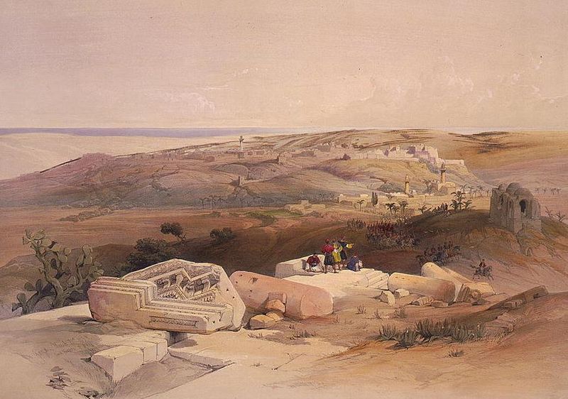
Painting of Gaza by David Roberts, 1839

Throughout the Roman period, Gaza was a prosperous city and received grants and attention from several emperors. A 500-member senate governed Gaza, and a diverse variety of Philistines, Greeks, Romans, Canaanites, Phoenicians, Jews, Egyptians, Persians, and Bedouin populated the city. Gaza's mint issued coins adorned with the busts of gods and emperors. During his visit in 130 CE, Emperor Hadrian personally inaugurated wrestling, boxing, and oratorical competitions in Gaza's new stadium, which became known from Alexandria to Damascus. The city was adorned with many pagan temples; the main cult being that of Marnas. Other temples were dedicated to Zeus, Helios, Aphrodite, Apollo, Athena and the local Tyche.

Christianity began to spread throughout Gaza in 250 CE, including in the port of Maiuma.  A large synagogue existed in Gaza in the 6th century, according to excavations. Conversion to Christianity in Gaza was accelerated under Saint Porphyrius between 396 and 420. In 402, Theodosius II ordered all eight of the city's pagan temples destroyed, and four years later Empress Aelia Eudocia commissioned the construction of a church atop the ruins of the Temple of Marnas. It was during this era that the Christian philosopher Aeneas of Gaza called Gaza, his hometown, "the Athens of Asia." Following the division of the Roman Empire in the 3rd century CE, Gaza remained under control of the Eastern Roman Empire that in turn became the Byzantine Empire. The city prospered and was an important center for the southern Palestine.

In 634 CE Gaza was besieged by the Rashidun army under general 'Amr ibn al-'As following the Battle of Ajnadayn between the Byzantine Empire and the Rashidun Caliphate in central Palestine. It was captured by Amr's forces about three years later. Believed to be the site where Muhammad's great grandfather Hashim ibn Abd Manaf was buried, Gaza was not destroyed and its inhabitants were not attacked by 'Amr's army despite the city's stiff and lengthy resistance, although its Byzantine garrison was massacred.

Gaza after surrender to British forces, 1918

The arrival of the Muslim Arabs brought significant changes to Gaza; at first some of its churches were transformed into mosques, including the present Great Mosque of Gaza (the oldest in the city), which was later rebuilt by Sultan Baibars, who endowed it with a huge manuscript library containing over 20,000 manuscripts in the 13th century, a large segment of the population swiftly adopted Islam, Arabic became the official language. In 767 Muhammad ibn Idris ash-Shafi'i was born in Gaza and lived his early childhood there; he founded the Shafi'i religious code, one of the four major Sunni Muslim schools of law (fiqh). Security, which was well-maintained during early Muslim rule, was the key to Gaza's prosperity. Although alcohol was banned in Islam, the Jewish and Christian communities were allowed to maintain wine production, and grapes, a major cash crop of the city, were exported mainly to Egypt.

Because it bordered the desert, Gaza was vulnerable to warring nomadic groups. In 796 it was destroyed during a civil war between the Arab tribes of the area. However, by the 10th century, the city had been rebuilt by the Abbasids; during Abbasid rule, the Jerusalemite geographer al-Muqaddasi described Gaza as "a large town lying on the highroad to Egypt on the border of the desert." In 977, the Fatimids established an agreement with their rivals, the Seljuk Turks, whereby the Fatimids would control Gaza and the land south of it, including Egypt and the Seljuks controlled the region north of the city.

The Crusaders conquered Gaza in 1100 and King Baldwin III built a castle in the city for the Knights Templar in 1149. He also had the Great Mosque converted into the Cathedral of Saint John.[ In 1154, Arab traveller al-Idrisi wrote Gaza "is today very populous and in the hands of the Crusaders." In 1187 the Ayyubids, led by Sultan Saladin, captured Gaza and later destroyed the city's fortifications in 1191. Richard the Lionheart apparently refortified the city in 1192, but the walls were dismantled again as a result of the Treaty of Ramla agreed upon months later in 1193. Ayyubid rule ended in 1260, after the Mongols under Hulagu Khan completely destroyed Gaza, which became his southernmost conquest.

Following Gaza's destruction by the Mongols, Muslim slave-soldiers based in Egypt known as the Mamluks began to administer the area. In 1277, the Mamluks made Gaza the capital of a province that bore its name, Mamlakat Ghazzah (Governorship of Gaza). This district extended along the coastal plain of Palestine from Rafah in the south to just north of Caesarea, and to the east as far as the Samarian highlands and the Hebron Hills. Other major towns in the province included Qaqun, Ludd, and Ramla. Gaza, which entered a period of tranquility under the Mamluks, was used by them as an outpost in their offensives against the Crusaders which ended in 1290.

In 1294 an earthquake devastated Gaza, and five years later the Mongols again destroyed all that had been restored by the Mamluks. Syrian geographer al-Dimashqi described Gaza in 1300 as a "city so rich in trees it looks like a cloth of brocade spread out upon the land." Under the governorship of Emir Sanjar al-Jawli, Gaza was transformed into a flourishing city and much of the Mamluk-era architecture dates back to his reign between 1311-1320 and again in 1342. In 1348 the Bubonic Plague spread to the city, killing the majority of its inhabitants and in 1352, Gaza suffered from a destructive flood, which was rare in that arid part of Palestine. However, when Arab traveler and writer Ibn Batutta visited the city in 1355, he noted that it was "large and populous, and has many mosques."

In 1516 Gaza—at the time, a small town with an inactive port, ruined buildings and reduced trade—was incorporated into the Ottoman Empire. The Ottoman army quickly and efficiently crushed a small-scale uprising, and the local population generally welcomed them as fellow Sunni Muslims. The city was then made the capital of Sanjak Gaza, part of the larger Province of Damascus.[49] The Ridwan family, named after governor Ridwan Pasha, was the first dynasty to govern Gaza and would continue to rule the city for over a century. Under Ahmad ibn Ridwan, the city became a cultural and religious center as a result of the partnership between the governor and prominent Islamic jurist Khayr al-Din al-Ramli, who was based in the nearby town of al-Ramla.

During the rule of Husayn Pasha, strife between the settled population and the nearby Bedouin tribes was dramatically reduced, allowing Gaza to peacefully prosper. The Ridwan period is described as a golden age for Gaza, a time when it served as the virtual "capital of Palestine."  The Great Mosque was restored, and six other mosques constructed, while Turkish baths and market stalls proliferated. After the death of Musa Pasha, Husayn's successor, Ottoman officials were appointed to govern in place of the Ridwans. The Ridwan period was Gaza's last golden age during Ottoman rule. After the family was removed from office, the city gradually declined.

Starting in the early 19th century, Gaza was culturally dominated by neighboring Egypt; Muhammad Ali of Egypt conquered Gaza in 1832. American scholar Edward Robinson visited the city in 1838, describing it as a "thickly populated" town larger than Jerusalem, with its Old City lying upon a hilltop, while its suburbs laid on the nearby plain. The city benefited from trade and commerce because of its strategic position on the caravan route between Egypt and northern Syria as well as from producing soap and cotton for trade with the government, local Arab tribes, and the Bedouin of Wadi Arabah and Ma'an. The bazaars of Gaza were well-supplied and were noted by Robinson as "far better" than those of Jerusalem. Robinson noted that virtually all of Gaza's vestiges of ancient history and antiquity had disappeared due to constant conflict and occupation. By the mid-19th century, Gaza's port was eclipsed by the ports of Jaffa and Haifa, but it retained its fishing fleet.

Beach in Gaza City

The Bubonic Plague struck Gaza again in 1839 and the city, lacking political and economic stability, went into a state of stagnation. In 1840 Egyptian and Ottoman troops battled outside of Gaza. The Ottomans won control of the territory, effectively ending Egyptian rule over Palestine. However, the battles brought about more death and destruction in Gaza whilst the city was still recovering from the effects of the plague.

While leading the Allied Forces during World War I, the British won control of the city during the Third Battle of Gaza in 1917. After the war, Gaza was included in Mandatory Palestine. In the 1930s and 1940s, Gaza underwent major expansion. New neighborhoods were built along the coast and the southern and eastern plains. International organizations and missionary groups funded most of this construction.  In the 1947 United Nations Partition Plan, Gaza was assigned to be part of an Arab state in Palestine but was occupied by Egypt following the 1948 Arab–Israeli War. Gaza's growing population was augmented by an influx of refugees fleeing nearby cities, towns and villages that were captured by Israel. In 1957, Egyptian president Gamal Abdel Nasser made a number of reforms in Gaza, which included expanding educational opportunities and the civil services, providing housing, and establishing local security forces.

Gaza was occupied by Israel during the 1967 Six-Day War following the defeat of the Egyptian Army. Frequent conflicts have erupted between Palestinians and the Israeli authorities in the city since the 1970s. The tensions led to the First Intifada in 1987. Gaza was a center of confrontation during this uprising, and economic conditions in the city worsened.

In September 1993, leaders of Israel and the Palestine Liberation Organization (PLO) signed the Oslo Accords. The agreement called for Palestinian administration of the Gaza Strip and the West Bank town of Jericho, which was implemented in May 1994. Israeli forces withdrew from Gaza, leaving a new Palestinian National Authority (PNA) to administer and police the city. The PNA, led by Yasser Arafat, chose Gaza as its first provincial headquarters. The newly established Palestinian National Council held its inaugural session in Gaza in March 1996.

In 2005, Israel withdrew its troops from the Gaza Strip and removed the thousands of Israelis who had settled in the territory. See Israel's unilateral disengagement plan of 2004. Since the Israeli withdrawal, Hamas has been engaged in a sometimes violent power struggle with its rival Palestinian organization Fatah. On January 25, 2006, Hamas won a surprise victory in the elections for the Palestinian Legislative Council, the legislature of the Palestinian National Authority. In 2007, Hamas overthrew Fatah forces in the Gaza Strip and Hamas members were dismissed from the PNA government in the West Bank in response. Currently, Hamas, recognized as a terror organization by most western countries, has de facto control of the city and Strip.

In March 2008, a coalition of human rights groups charged that the Israeli blockade of the city had caused the humanitarian situation in Gaza to have reached its worst point since Israel occupied the territory in the 1967 Six-Day War, and that Israeli air strikes targeting militants in the densely populated areas have often killed bystanders as well. In 2008, Israel commenced an assault against Gaza. Israel stated the strikes were in response to repetitive rocket and mortar attacks from the Gaza Strip into Israel since 2005, while the Palestinians stated that they were responding to Israel's military incursions and blockade of the Gaza Strip. In January 2009, at least 1,300 Palestinians were killed in the conflict.

In November 2012, after a week of conflict between Israel and Palestinian militant groups, a ceasefire brokered by Egypt was announced on November 21.[69] UN OCHA says 2,205 Palestinians (including at least 1,483 civilians) and 71 Israelis (including 66 soldiers) and one foreign national in Israel were killed in the 2014 Israel–Gaza conflict. According to an analysis by the New York Times, men ages 20–29, who are most likely to be militants, are most overrepresented in the death toll.
(source)